and big it is – the Pacific Ocean is by far the largest body of water on this planet, covering nearly one third of its total surface. To put it into scale - it is so vast that you could put all 5 [land] continents into it and still have quite a bit of space left over.
It is an ‘ocean of islands’ with over 20.000 of them scattered throughout, mainly clustered together into groups like the Marshall and Caroline islands in Micronesia, the Solomon, Vanuatu and Fiji islands in Melanesia and Tonga and the Society islands in Polynesia, just to name a few of the more commonly known. Looking at the immense distance the Pacific covers you must give credit to the Austronesian people from the SE Asian belt of islands for their efforts in populating it. About 3000 B.C. their early navigators began an unparalleled seaborne expansion into the unknown, exploring and settling this vastness from east to west, making it undoubtedly mankind’s greatest maritime achievement. By about 1500 B.C. the first pioneers in their primitive outrigger-type vessels traversed several thousand sea miles reaching the Caroline islands, then Fiji, Samoa and Tonga. From there the expansion went towards French Polynesia and Hawaii. To make this achievement even more courageous - most of this exploration occurred against the prevailing winds using ‘kavenga’ or star path navigation, a skill refined over centuries and handed down through the generations. As folk legend tells amongst the islanders, the navigator ‘Kupe’ voyaged around 600-800 A.D. from Tonga south west to finally discover last but not least Aotea Roa, the ‘Land of the Long White Cloud’ or New Zealand.
Our first destination in the South Pacific was going to be Fatu Hiva in the Marquesas archipelago in French Polynesia. Ahead were about 3000 miles of open ocean. After the last windward passage the pilot charts promised a downwind journey. We set off from Puerto Ayora on Santa Cruz island on June 5, making a last stop over at Tortuga Bay. After only 5 days in port, the nutrient rich waters delivered to the Galapagos by the Humboldt current made our hulls look like they had grown a beard, with algae and barnacles growing everywhere. After an hour of scraping and scratching it looked again much sleeker and ready for the westbound passage.
The first 12 hours were spent motoring, and then we found a favorable current with some southeasterly winds. What followed was more than expected – 6 days of continuous winds of 15-20kn on the beam with currents going west pushing up the record of our daily average to 180 miles and we started to dream of getting there in half the time. Of course it was too good to be true and the reality of the doldrums returned. We were becalmed, 3 days of virtually no wind and a mirror like ocean had us gently motoring.

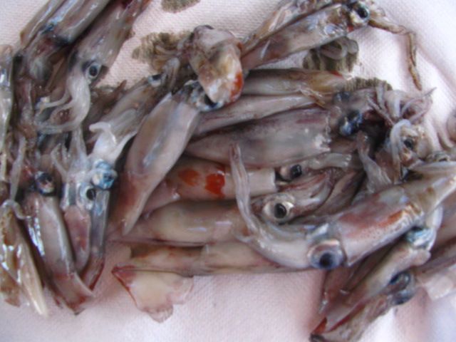
Collecting flying fish off the deck is a regular job, but one morning proof of the abundant sea life was lying neatly on our galley floor – a pair of suicide squid. There was no other way they could have entered but for a small gap in the deck’s hatch above the stove. Once checking outside we found their companions – spread all over the deck. Unfortunately most of them managed to expel their ink while being swept onto the deck. We looked down the hulls and - what a mess!!
We turned off the engines and came to a complete stand still, a wonderful and luxurious experience one doesn’t often afford oneself. Then we spent another hour scrubbing the deck and hull-s [a cat’s disadvantage, it does exist] before listening again to the amazing stillness, while having a dinner of fresh squid pasta and gazing at the most brilliant sunset.


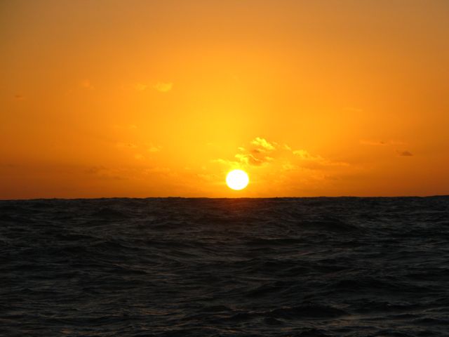
Sunsets come in all different shapes and colours and are ever so photogenic. One thing however you just can’t capture on screen is the experience of observing a full cycle of the moon. While being in the routine of regular night watches it is a magic spectacle to watch the moon changing shape from full to new moon and back to full, noting the time delays every day and the effect it has on the night sky. Out here on the ocean it would be a paradise for anyone with a telescope –if only the boat wouldn’t rock so much ….
We also had another interlude with our electrical supply – and much less appreciated as it happened just during dinner!!! For still unknown reasons the reliable starboard engine alternator started to smoke and as a result of overheating burnt out. Compared to the last port alternator repairs off the Moroccan coast [never to forget ….] at least it was completely calm and the exchange happened in ‘civilized’ circumstances. Now we run out of spares and need to get some new alternators shipped to Tahiti.


The trade winds came back again, with a vengeance. With our 2 jibs poled out like butterfly wings we flew west with gusts up to 25-30 kn. Then it all calmed down again and it seemed as if we wouldn’t get any closer, almost going … under.


By then we were ready for another swim and hull scrub. You wouldn’t believe that at continuous speeds of 6-7 knots algae and barnacles would be able to attach themselves, but they bloody well do!!! and lots of them. Another 2 hours spent scraping the hull-s and scratching open the various water inlets. Doing this in the middle of the Pacific with some 5000m of water underneath is an awesome if not eerie experience. We started motoring again and 2 days later out of nowhere, without a change in the weather pattern, the wind started again.
Back to the routine of watches, eating and sleeping – and fishing. It took 2 days, but with a homemade lure […. Karsten, we miss you] we snagged a beautiful mahi mahi. It is something very special to be able to catch a fish and turn it into a superb dinner [thanks to August and Christian] – there and then, fresh from the ocean - the essence of life.


On June 27 at 1541h the rugged peaks of Fatu Hiva, the most eastern island of the Marquesas peeled themselves out of the horizon. We finally dropped anchor at 0240h in the middle of the night without being able to see much of what many cruisers previously described as one of the most beautiful and spectacular anchorages in the world – ‘Hanavave Bay’, also known as ‘The Bay of the Virgins’.
After so many days at sea arriving in the dark felt a bit like having ‘sex with the lights out’, but the morning after made up for it.


For the record, the total distance covered from the Galapagos to Fatu Hiva was 2998nm. It took 24 days and our highest daily mileage was 182nm, the average speed was 5.9kn and our max speed was 13.2kn, clocked by August on the helm sometime in the middle of a night with force 7 winds.
Being penned up for so long on 50 sqm our legs were itching to stretch out. The very next day we organized for some Marquesans to take us in their boat to Omoa Bay at the southern end of the island. We marched 18km through the lush tropical vegetation, crossing ridges in the clouds, 680m above sea level. The timing was perfect as we descended into our bay with the moonlight guiding us.


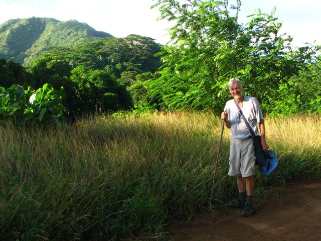


After attending a fabulous early Sunday church service where the entire community gathered, singing vivaciously throughout the entire service, we left Fatu Hiva on a high note and set sail for Hiva Oa, the next bigger island to the north to clear in at the Gendarmerie. It was this island Paul Gauguin spent the last few years of his tortured artist life creating the famous paintings so inspired by living in the South Pacific and in particular with the Marquesan people. We also took the opportunity to explore some ‘maraes’, the very spiritual and sacred sites of the Polynesian culture on the remote and rugged northeastern coast in search of some the largest stone tikis in the South Pacific, some more than 3m tall.


